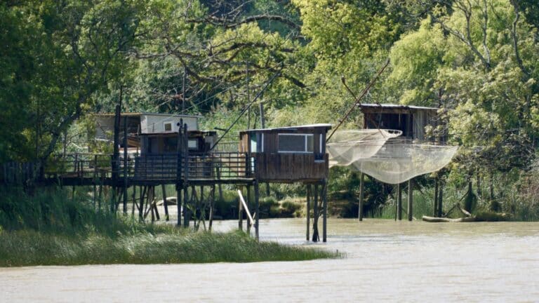
How can we successfully protect marine protected areas from illegal fishing activities without deploying very costly human surveillance over the protected surfaces? This is the challenge currently posed to guards and managers of marine areas worldwide, which Tap-a-boat attempts to address.
A global challenge: monitoring vast spaces with limited resources
This mobile application aims to engage a very broad audience, seemingly unaware of the preservation of fishery resources, including players addicted to mini-games or simply smartphone owners. The rules of the game are very simple (see the presentation video): tap on the colored spots that appear on the screen as quickly as possible to earn points. Without even realizing it, the player is participating in the monitoring of protected marine areas sometimes located on the other side of the globe.
Tap-a-boat: participatory monitoring via smartphone
A dashboard common to all managers registered in the application allows them to track the identification of fishing vessels as well as to exchange and communicate with each other.
Indeed, the map background displayed on the screen actually comes from satellite data on protected marine areas. Illegal vessels present in the area are visible in these images and identified by the player, who earns bonus points by clicking on them. The satellite coordinates of the reported boats are then sent to the managers of the relevant area.
A promising innovation for marine area management
Monitoring marine spaces requires significant financial and human resources that marine areas cannot mobilize, and real-time analysis of satellite data by the managers of these areas alone is impossible.
The Fishackathon: bridging worlds to innovate differently
This type of meeting between actors from different worlds produces surprising results that go beyond usual solutions. Other environmental issues could thus be addressed and analyzed using these working methods [2].
Another interesting aspect of this game is the context in which it was created: the Fishackathon. This event was organized last April simultaneously in several cities around the world by the U.S. government in collaboration with private stakeholders.
Built on the model of hackathons, gatherings of participants from very different backgrounds (often including developers) tasked with responding to a challenge within a limited time,
The power of gaming to raise awareness and engage
The playful aspect of this type of event and some of the proposed solutions should finally be emphasized: the game-based approach can raise public awareness of environmental causes much more effectively than informational materials or formal events. The simulation on climate change "Heat Wave in My City", organized last December by CliMates and Vertigo Lab, is an excellent illustration of this.
[[[NUM]]] The Ministry of the Environment is organizing, for example, from [[NUM]] to [[NUM]] May next year, a hackathon on innovative energy consumption services.
The winners of the Fishackathon will be announced on June 8, during World Oceans Day, with financial and technical support to develop their project. Let's wish good luck to Tap-a-boat!
[1] See on this subject the publication by Julien Rochette and Glen Wright, researchers at IDDRI: http://www.iddri.org/Publications/Collections/Syntheses/IB0416_GW%20et%20al._high%20seas.pdf
References
- [1] See the publication by Julien Rochette and Glen Wright, researchers at IDDRI: http://www.iddri.org/Publications/Collections/Syntheses/IB0416_GW%20et%20al._high%20seas.pdf
- image article application detection illegal fishing smartphone